Toggle navigation
Survey Documents
Advanced Search
Supporting Data
Companies
Surveyors
Communities
Original Townships
APIs
Survey Documents API
Tutorial
About
Contact
Search
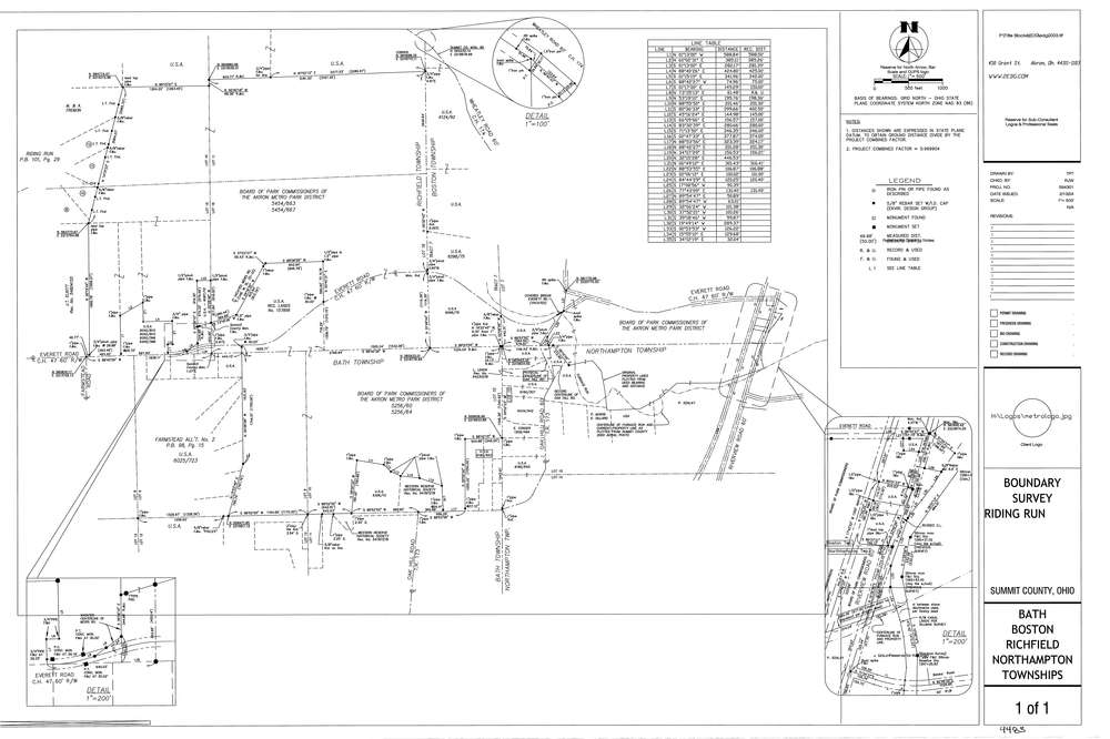
9483
Download lotsplits9483.tif
GIS Data
Latitude:
41.2049030999999
Longitude:
-81.5903366
Identification
Survey identifier:
9483
Context
Original township:
Bath,Boston,Richfield,Northfield
Community list:
Bath, Boston, Northampton, Richfield
Surveyed on:
08/17/2004
Description
Owner:
Board Of Park Commissioners
Description:
Also Bordering Roads: Wheatley Rd. Farmstead Rd`
Primary road:
Everett Rd
Secondary road:
Oak Hill Rd
Near intersection:
Riverview Rd
Acreage:
Survey Locators
Tract list:
7
Lot list:
10, 11, 12, 14, 15, 16, 8, 9
Section list:
Quarter:
Surveyor
Surveyor number:
4782
Surveyor name:
Acker, Jack
Company:
Environmental Design Group
Document Data
Scan File Name:
lotsplits9483.tif
Scan Pages:
1
Drawer location: