Toggle navigation
Survey Documents
Advanced Search
Supporting Data
Companies
Surveyors
Communities
Original Townships
APIs
Survey Documents API
Tutorial
About
Contact
Search
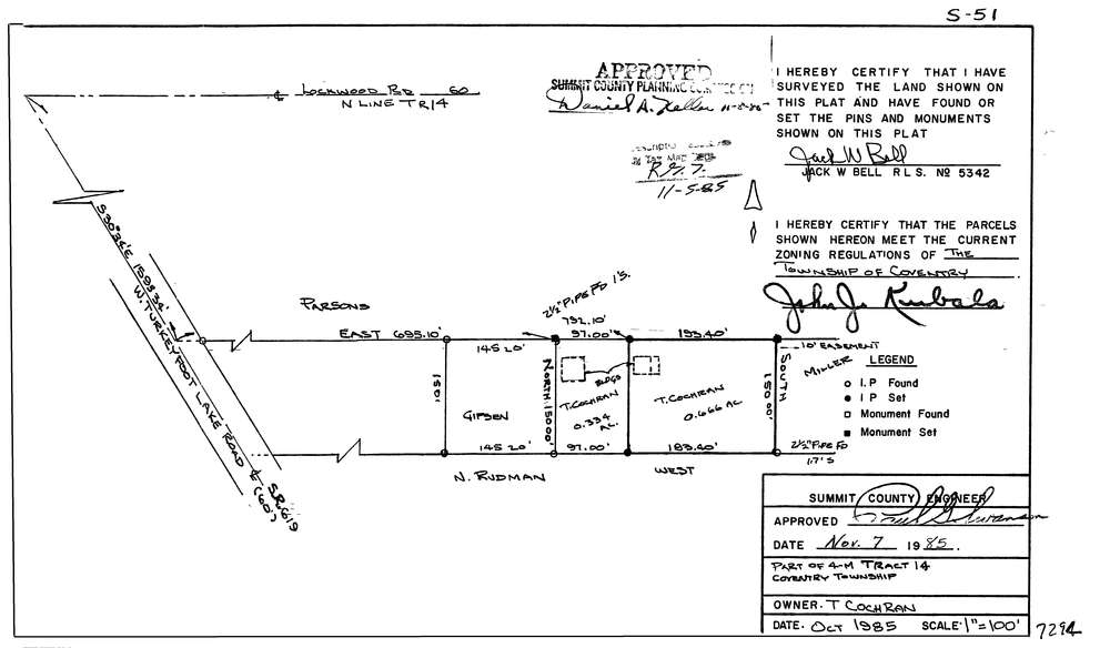
7294
Download lotsplits7294.tif
GIS Data
Latitude:
40.9956038999998
Longitude:
-81.5801426
Identification
Survey identifier:
7294
Context
Original township:
Coventry
Community list:
Coventry
Surveyed on:
10/01/1985
Description
Owner:
Cochran
Description:
Primary road:
West Turkeyfoot Lake Rd
Secondary road:
Near intersection:
Lockwood Rd
Acreage:
Survey Locators
Tract list:
14
Lot list:
Section list:
Quarter:
Surveyor
Surveyor number:
5342
Surveyor name:
Bell, Jack W.
Company:
Document Data
Scan File Name:
lotsplits7294.tif
Scan Pages:
1
Drawer location: