Toggle navigation
Survey Documents
Advanced Search
Supporting Data
Companies
Surveyors
Communities
Original Townships
APIs
Survey Documents API
Tutorial
About
Contact
Search
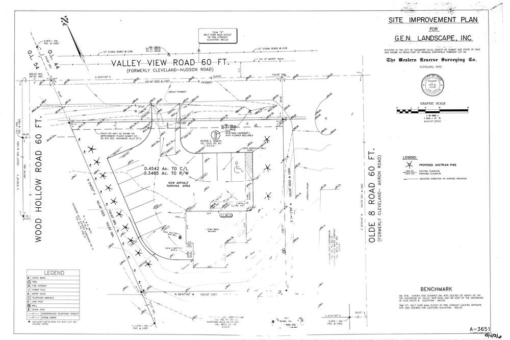
9496
Download lotsplits9496.tif
GIS Data
Latitude:
41.3267888999998
Longitude:
-81.5387637
Identification
Survey identifier:
9496
Context
Original township:
Northfield
Community list:
Sagamore Hills
Surveyed on:
08/01/2000
Description
Owner:
Description:
Primary road:
Valley View Rd
Secondary road:
Near intersection:
Wood Hollow Rd
Acreage:
0.4542
Survey Locators
Tract list:
Lot list:
44
Section list:
Quarter:
Surveyor
Surveyor number:
5129
Surveyor name:
Hantel, Richard F.
Company:
The Western Reserve Surveying Company
Document Data
Scan File Name:
lotsplits9496.tif
Scan Pages:
1
Drawer location: