Toggle navigation
Survey Documents
Advanced Search
Supporting Data
Companies
Surveyors
Communities
Original Townships
APIs
Survey Documents API
Tutorial
About
Contact
Search
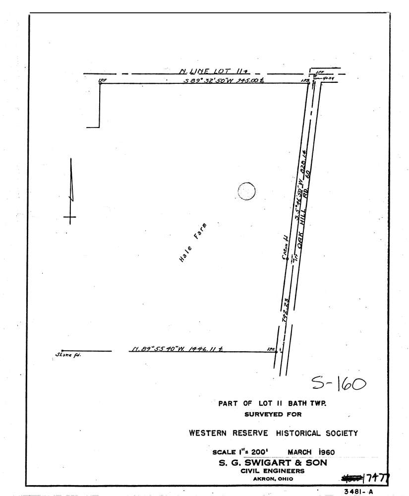
7477
Download lotsplits7477.tif
GIS Data
Latitude:
41.1940639999998
Longitude:
-81.5936987
Identification
Survey identifier:
7477
Context
Original township:
Bath
Community list:
Bath
Surveyed on:
03/01/1960
Description
Owner:
Western Reserve Historical Soc
Description:
Hale Farm
Primary road:
Oak Hill Rd
Secondary road:
Near intersection:
Ira Rd
Acreage:
Survey Locators
Tract list:
Lot list:
11
Section list:
Quarter:
Surveyor
Surveyor number:
0
Surveyor name:
Company:
S.G. Swigart & Son
Document Data
Scan File Name:
lotsplits7477.tif
Scan Pages:
1
Drawer location: