Toggle navigation
Survey Documents
Advanced Search
Supporting Data
Companies
Surveyors
Communities
Original Townships
APIs
Survey Documents API
Tutorial
About
Contact
Search
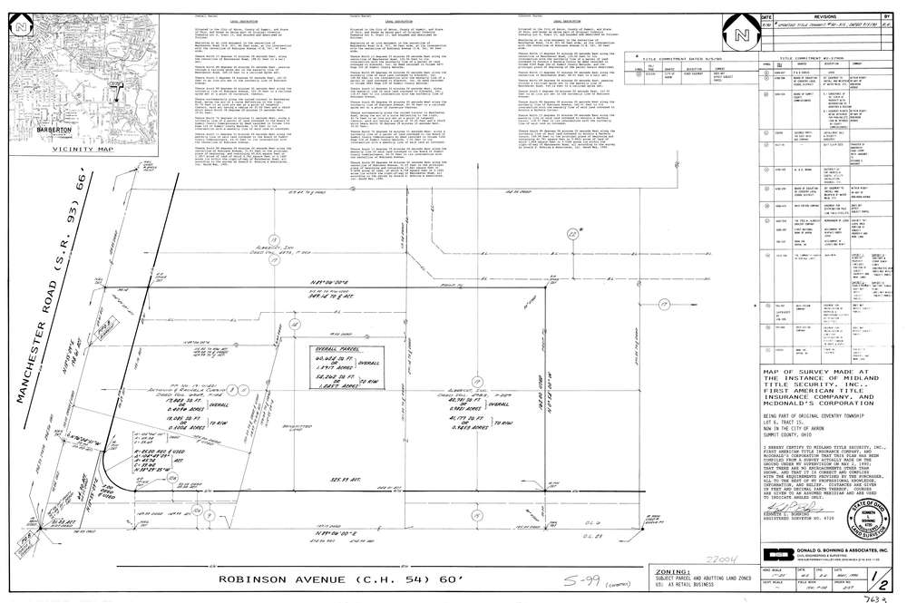
7633
Download lotsplits7633.tif
GIS Data
Latitude:
41.0108130999999
Longitude:
-81.5538571
Identification
Survey identifier:
7633
Context
Original township:
Coventry
Community list:
Coventry
Surveyed on:
05/01/1990
Description
Owner:
McDonald's Corporation
Description:
Primary road:
Manchester Rd
Secondary road:
Robinson Ave
Near intersection:
Acreage:
2.7828
Survey Locators
Tract list:
15
Lot list:
6
Section list:
Quarter:
Surveyor
Surveyor number:
6720
Surveyor name:
Bohning, Kenneth L.
Company:
Donald G. Bohning & Associates, Inc.
Document Data
Scan File Name:
lotsplits7633.tif
Scan Pages:
1
Drawer location: