Toggle navigation
Survey Documents
Advanced Search
Supporting Data
Companies
Surveyors
Communities
Original Townships
APIs
Survey Documents API
Tutorial
About
Contact
Search
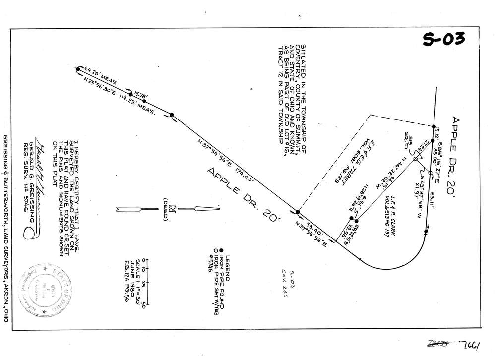
7661
Download lotsplits7661.tif
GIS Data
Latitude:
41.0049591999999
Longitude:
-81.544485
Identification
Survey identifier:
7661
Context
Original township:
Coventry
Community list:
Coventry
Surveyed on:
06/02/1980
Description
Owner:
Description:
Primary road:
Apple Dr
Secondary road:
Near intersection:
Portage Lakes Dr
Acreage:
Survey Locators
Tract list:
12
Lot list:
16
Section list:
Quarter:
Surveyor
Surveyor number:
5746
Surveyor name:
Greissing, Gerald G.
Company:
Greissing & Butterworth
Document Data
Scan File Name:
lotsplits7661.tif
Scan Pages:
1
Drawer location: