Toggle navigation
Survey Documents
Advanced Search
Supporting Data
Companies
Surveyors
Communities
Original Townships
APIs
Survey Documents API
Tutorial
About
Contact
Search
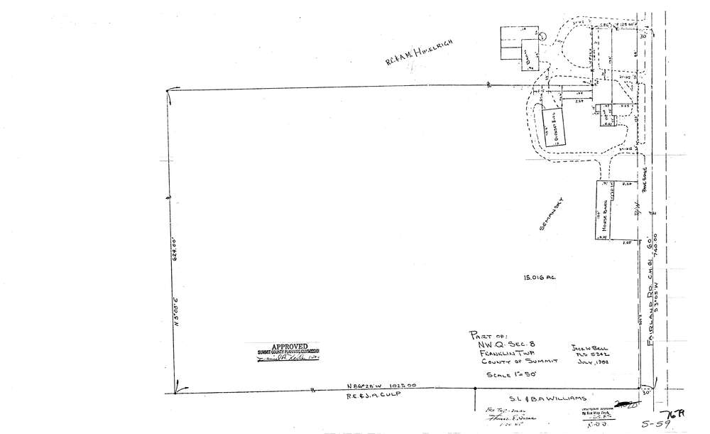
7679
Download lotsplits7679.tif
GIS Data
Latitude:
40.9839722999998
Longitude:
-81.6228162
Identification
Survey identifier:
7679
Context
Original township:
Franklin
Community list:
Franklin
Surveyed on:
07/01/1982
Description
Owner:
Description:
Primary road:
Fairland Rd
Secondary road:
Near intersection:
Vanderhoof Rd
Acreage:
Survey Locators
Tract list:
Lot list:
Section list:
8
Quarter:
NW
Surveyor
Surveyor number:
5342
Surveyor name:
Bell, Jack W.
Company:
Document Data
Scan File Name:
lotsplits7679.tif
Scan Pages:
1
Drawer location: