Toggle navigation
Survey Documents
Advanced Search
Supporting Data
Companies
Surveyors
Communities
Original Townships
APIs
Survey Documents API
Tutorial
About
Contact
Search
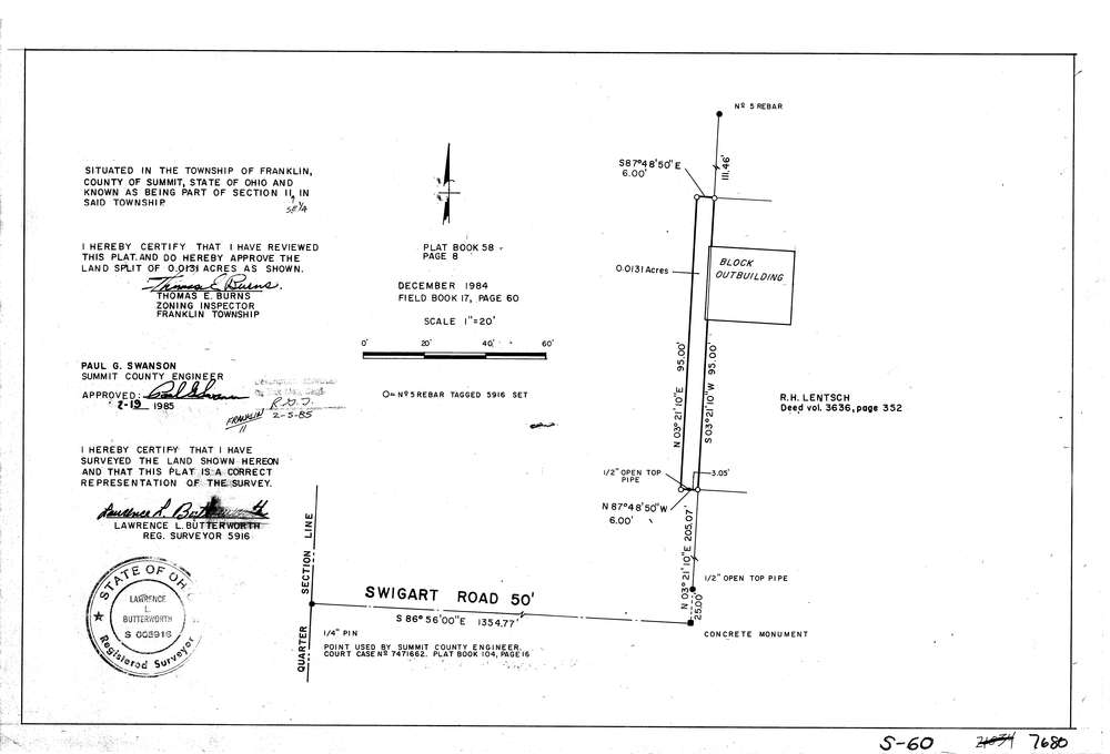
7680
Download lotsplits7680.tif
GIS Data
Latitude:
40.9742599999999
Longitude:
-81.560354
Identification
Survey identifier:
7680
Context
Original township:
Franklin
Community list:
Franklin
Surveyed on:
12/01/1984
Description
Owner:
Description:
Primary road:
Swigart Rd
Secondary road:
Near intersection:
Manchester Rd
Acreage:
0.0131
Survey Locators
Tract list:
Lot list:
Section list:
11
Quarter:
SE
Surveyor
Surveyor number:
5916
Surveyor name:
Butterworth, Lawrence L.
Company:
Greissing & Butterworth
Document Data
Scan File Name:
lotsplits7680.tif
Scan Pages:
1
Drawer location: