Toggle navigation
Survey Documents
Advanced Search
Supporting Data
Companies
Surveyors
Communities
Original Townships
APIs
Survey Documents API
Tutorial
About
Contact
Search
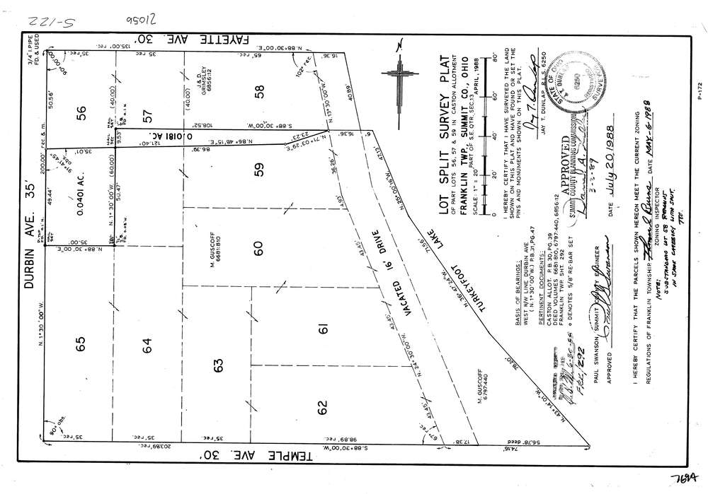
7694
Download lotsplits7694.tif
GIS Data
Latitude:
40.9612927999998
Longitude:
-81.541371
Identification
Survey identifier:
7694
Context
Original township:
Franklin
Community list:
Franklin
Surveyed on:
07/01/1988
Description
Owner:
Description:
Primary road:
Durbin Ave
Secondary road:
Near intersection:
Fayette Ave
Acreage:
0.0582
Survey Locators
Tract list:
Lot list:
Section list:
13
Quarter:
SE
Surveyor
Surveyor number:
6250
Surveyor name:
Dunlap, Jay T.
Company:
Document Data
Scan File Name:
lotsplits7694.tif
Scan Pages:
1
Drawer location: