Toggle navigation
Survey Documents
Advanced Search
Supporting Data
Companies
Surveyors
Communities
Original Townships
APIs
Survey Documents API
Tutorial
About
Contact
Search
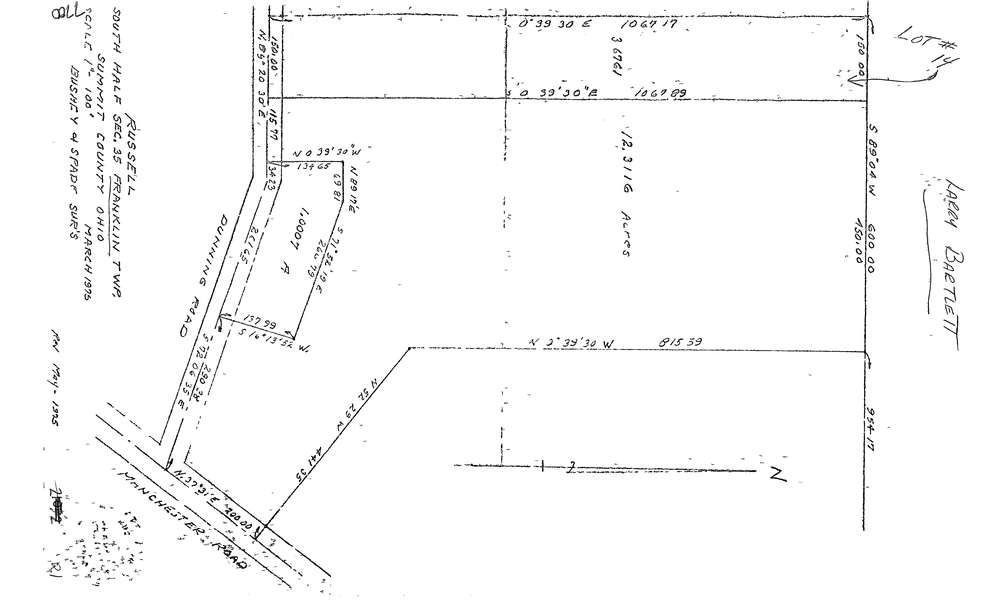
7700
Download lotsplits7700.tif
GIS Data
Latitude:
40.9132529999998
Longitude:
-81.565075
Identification
Survey identifier:
7700
Context
Original township:
Franklin
Community list:
Franklin
Surveyed on:
03/01/1975
Description
Owner:
Description:
Primary road:
Dunning Rd
Secondary road:
Manchester Rd
Near intersection:
Acreage:
16.9884
Survey Locators
Tract list:
Lot list:
Section list:
35
Quarter:
Surveyor
Surveyor number:
0
Surveyor name:
Company:
Bushey & Spade Surveyors
Document Data
Scan File Name:
lotsplits7700.tif
Scan Pages:
1
Drawer location: