Toggle navigation
Survey Documents
Advanced Search
Supporting Data
Companies
Surveyors
Communities
Original Townships
APIs
Survey Documents API
Tutorial
About
Contact
Search
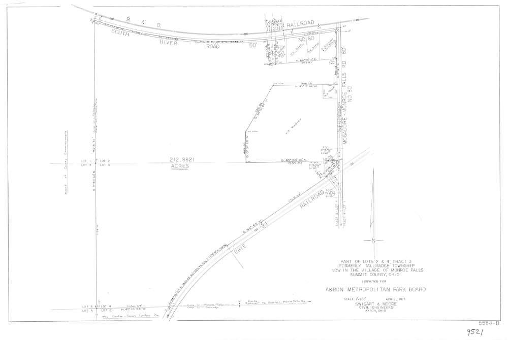
9521
Download lotsplits9521.tif
GIS Data
Latitude:
41.1298474999998
Longitude:
-81.4209057
Identification
Survey identifier:
9521
Context
Original township:
Tallmadge
Community list:
Munroe Falls
Surveyed on:
04/01/1978
Description
Owner:
Akron Metropolitan Park Board
Description:
Primary road:
Mogadore-Munroe Falls Rd
Secondary road:
South River Rd
Near intersection:
Acreage:
212.8821
Survey Locators
Tract list:
3
Lot list:
2, 4
Section list:
Quarter:
Surveyor
Surveyor number:
Surveyor name:
Company:
Swigart & Moore
Document Data
Scan File Name:
lotsplits9521.tif
Scan Pages:
1
Drawer location: