Toggle navigation
Survey Documents
Advanced Search
Supporting Data
Companies
Surveyors
Communities
Original Townships
APIs
Survey Documents API
Tutorial
About
Contact
Search
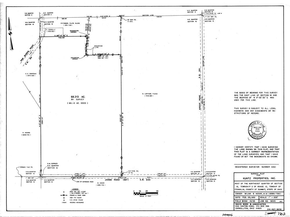
7702
Download lotsplits7702.tif
GIS Data
Latitude:
40.9677632999998
Longitude:
-81.5986194
Identification
Survey identifier:
7702
Context
Original township:
Franklin
Community list:
Franklin
Surveyed on:
02/25/1991
Description
Owner:
Kocar
Description:
Primary road:
Johns Rd
Secondary road:
Van Buren Rd
Near intersection:
Grove Rd
Acreage:
68.213
Survey Locators
Tract list:
Lot list:
Section list:
16
Quarter:
NE
Surveyor
Surveyor number:
6321
Surveyor name:
Bodo, David J.
Company:
David Bodo & Associates
Document Data
Scan File Name:
lotsplits7702.tif
Scan Pages:
1
Drawer location: