Toggle navigation
Survey Documents
Advanced Search
Supporting Data
Companies
Surveyors
Communities
Original Townships
APIs
Survey Documents API
Tutorial
About
Contact
Search
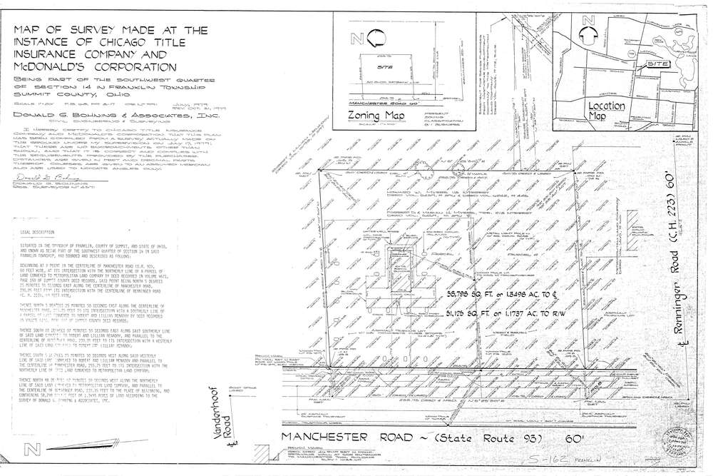
7758
Download lotsplits7758.tif
GIS Data
Latitude:
40.9622605999999
Longitude:
-81.5653154
Identification
Survey identifier:
7758
Context
Original township:
Franklin
Community list:
Franklin
Surveyed on:
10/31/1979
Description
Owner:
Description:
Primary road:
Manchester Rd
Secondary road:
Near intersection:
Renninger Rd
Acreage:
1.3498
Survey Locators
Tract list:
Lot list:
Section list:
14
Quarter:
SW
Surveyor
Surveyor number:
4571
Surveyor name:
Bohning, Donald G.
Company:
Donald G. Bohning & Associates, Inc.
Document Data
Scan File Name:
lotsplits7758.tif
Scan Pages:
1
Drawer location: