Toggle navigation
Survey Documents
Advanced Search
Supporting Data
Companies
Surveyors
Communities
Original Townships
APIs
Survey Documents API
Tutorial
About
Contact
Search
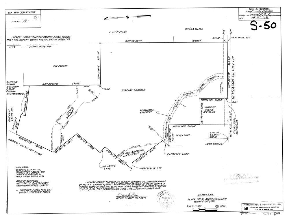
7802
Download lotsplits7802.tif
GIS Data
Latitude:
40.9113134999998
Longitude:
-81.5213413
Identification
Survey identifier:
7802
Context
Original township:
Green
Community list:
Green
Surveyed on:
10/01/1983
Description
Owner:
Description:
Primary road:
Mt Pleasant Rd
Secondary road:
Near intersection:
Pine Knoll Dr
Acreage:
25.8385
Survey Locators
Tract list:
Lot list:
Section list:
31
Quarter:
SE
Surveyor
Surveyor number:
5874
Surveyor name:
Bair, Bruce M.
Company:
Hammontree & Associates
Document Data
Scan File Name:
lotsplits7802.tif
Scan Pages:
1
Drawer location: