Toggle navigation
Survey Documents
Advanced Search
Supporting Data
Companies
Surveyors
Communities
Original Townships
APIs
Survey Documents API
Tutorial
About
Contact
Search
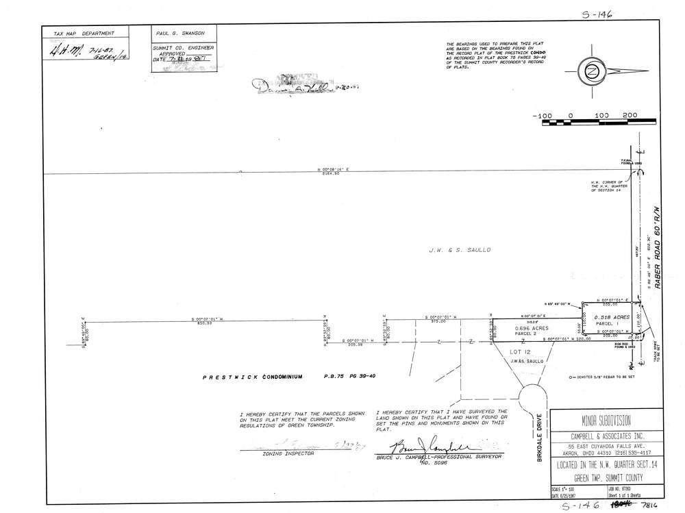
7816
Download lotsplits7816.tif
GIS Data
Latitude:
40.9655335999999
Longitude:
-81.4534352
Identification
Survey identifier:
7816
Context
Original township:
Green
Community list:
Green
Surveyed on:
06/25/1987
Description
Owner:
Description:
Primary road:
Raber Rd
Secondary road:
Birkdale Dr
Near intersection:
Acreage:
1.214
Survey Locators
Tract list:
Lot list:
Section list:
14
Quarter:
NW
Surveyor
Surveyor number:
5096
Surveyor name:
Campbell, Bruce J.
Company:
Campbell & Associates
Document Data
Scan File Name:
lotsplits7816.tif
Scan Pages:
1
Drawer location: