Toggle navigation
Survey Documents
Advanced Search
Supporting Data
Companies
Surveyors
Communities
Original Townships
APIs
Survey Documents API
Tutorial
About
Contact
Search
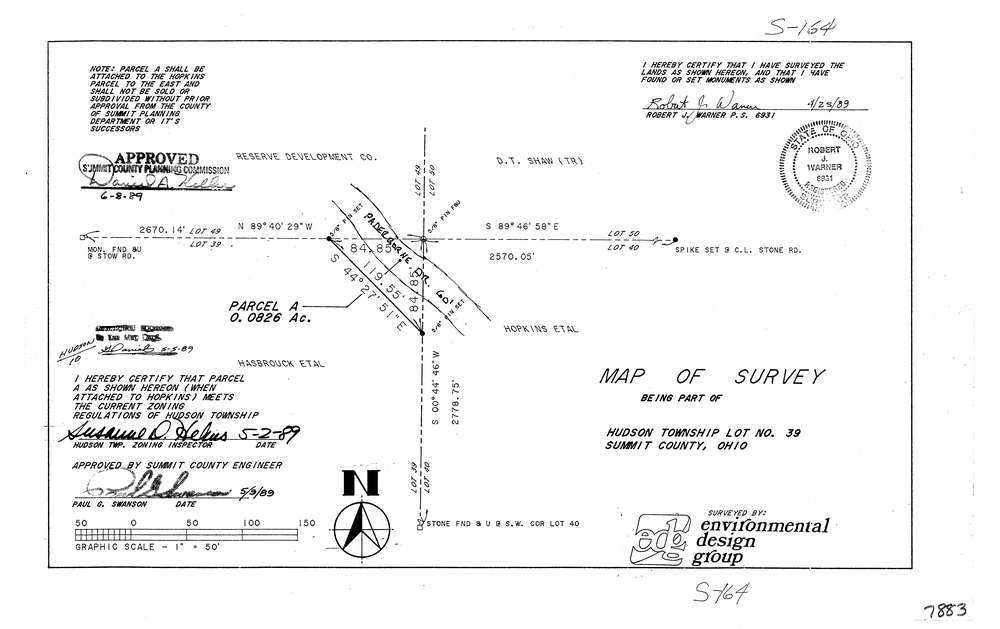
7883
Download lotsplits7883.tif
GIS Data
Latitude:
41.2322999999999
Longitude:
-81.401492
Identification
Survey identifier:
7883
Context
Original township:
Hudson
Community list:
Hudson
Surveyed on:
04/25/1989
Description
Owner:
Description:
Common Corner Lots 39, 49, 50, 40
Primary road:
Paderborne Dr
Secondary road:
Stow Rd
Near intersection:
Stone Rd
Acreage:
0.0826
Survey Locators
Tract list:
Lot list:
39
Section list:
Quarter:
Surveyor
Surveyor number:
6931
Surveyor name:
Warner, Robert J.
Company:
Environmental Design Group
Document Data
Scan File Name:
lotsplits7883.tif
Scan Pages:
1
Drawer location: