Toggle navigation
Survey Documents
Advanced Search
Supporting Data
Companies
Surveyors
Communities
Original Townships
APIs
Survey Documents API
Tutorial
About
Contact
Search
7890
Download lotsplits7890.tif
GIS Data
Latitude:
41.2184279999999
Longitude:
-81.467314
Identification
Survey identifier:
7890
Context
Original township:
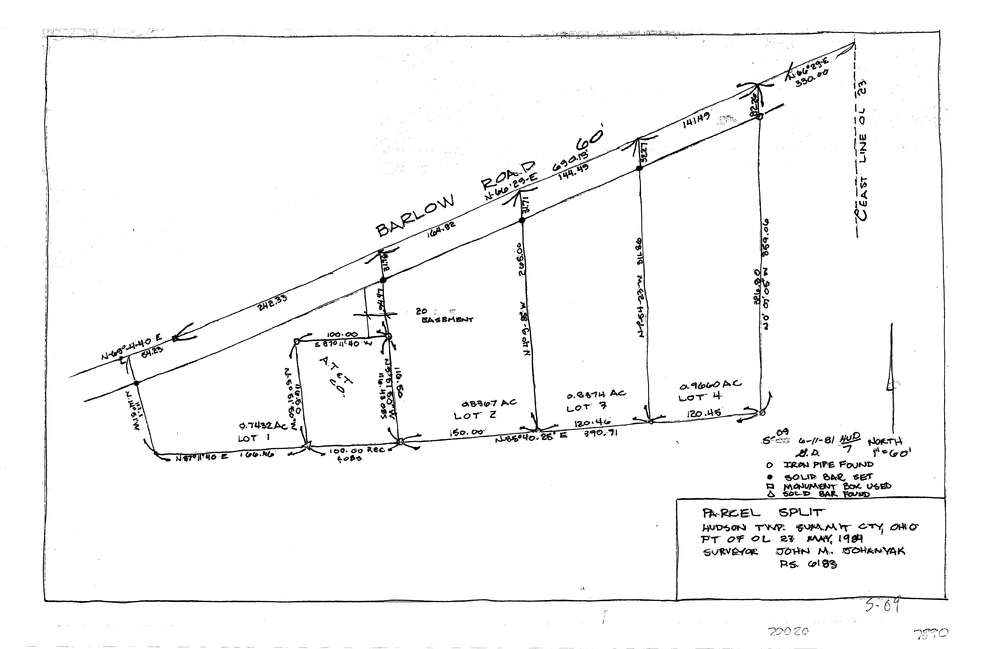
Hudson
Community list:
Hudson
Surveyed on:
05/01/1981
Description
Owner:
Description:
Primary road:
Barlow Rd
Secondary road:
Near intersection:
Acreage:
0.7432
Survey Locators
Tract list:
Lot list:
23
Section list:
Quarter:
Surveyor
Surveyor number:
6183
Surveyor name:
Johanyak, John M.
Company:
Document Data
Scan File Name:
lotsplits7890.tif
Scan Pages:
1
Drawer location: