Toggle navigation
Survey Documents
Advanced Search
Supporting Data
Companies
Surveyors
Communities
Original Townships
APIs
Survey Documents API
Tutorial
About
Contact
Search
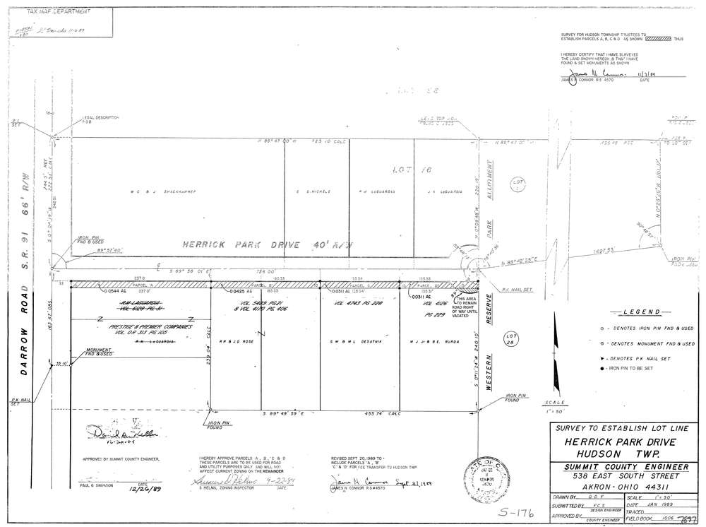
7897
Download lotsplits7897.tif
GIS Data
Latitude:
41.2614289999999
Longitude:
-81.438861
Identification
Survey identifier:
7897
Context
Original township:
Hudson
Community list:
Hudson
Surveyed on:
11/07/1989
Description
Owner:
Description:
Survey To Establish Lot Line
Primary road:
Herrick Park Dr
Secondary road:
Near intersection:
Darrow Rd
Acreage:
Survey Locators
Tract list:
Lot list:
76, 86
Section list:
Quarter:
Surveyor
Surveyor number:
4570
Surveyor name:
Connor, James N.
Company:
Jc Connor & Associates, Inc.
Document Data
Scan File Name:
lotsplits7897.tif
Scan Pages:
1
Drawer location: