Toggle navigation
Survey Documents
Advanced Search
Supporting Data
Companies
Surveyors
Communities
Original Townships
APIs
Survey Documents API
Tutorial
About
Contact
Search
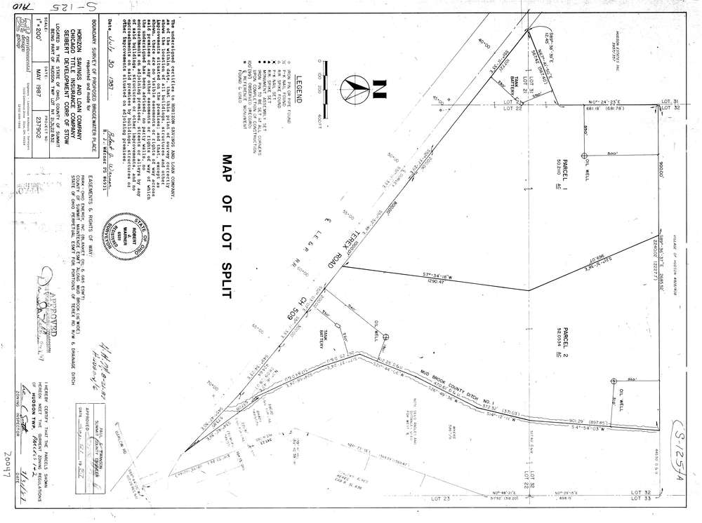
7910
Download lotsplits7910.tif
GIS Data
Latitude:
41.2228099999999
Longitude:
-81.475575
Identification
Survey identifier:
7910
Context
Original township:
Hudson
Community list:
Hudson
Surveyed on:
07/30/1987
Description
Owner:
Description:
Boundary Survey Of Proposed Bridgewater Place
Primary road:
Terex Rd
Secondary road:
Near intersection:
Barlow Rd
Acreage:
102.2644
Survey Locators
Tract list:
Lot list:
21, 22, 31, 32
Section list:
Quarter:
Surveyor
Surveyor number:
6931
Surveyor name:
Warner, Robert J.
Company:
Environmental Design Group
Document Data
Scan File Name:
lotsplits7910.tif
Scan Pages:
1
Drawer location: