Toggle navigation
Survey Documents
Advanced Search
Supporting Data
Companies
Surveyors
Communities
Original Townships
APIs
Survey Documents API
Tutorial
About
Contact
Search
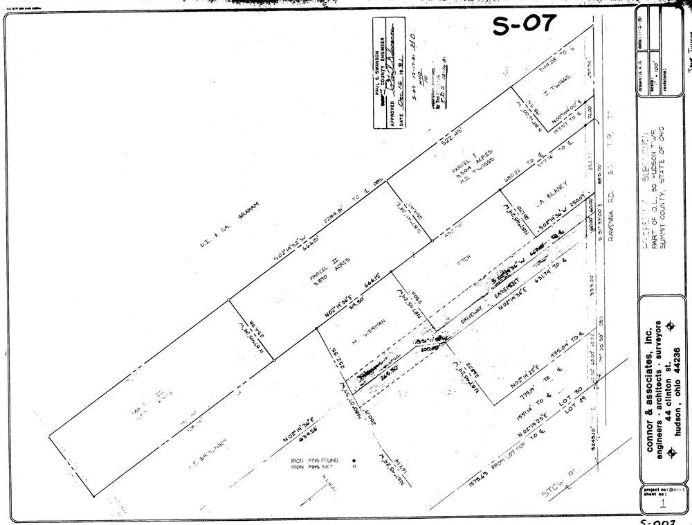
7934
Download hu_s_007.tif
GIS Data
Latitude:
41.2196789999999
Longitude:
-81.399658
Identification
Survey identifier:
7934
Context
Original township:
Hudson
Community list:
Hudson
Surveyed on:
11/06/1981
Description
Owner:
Description:
Primary road:
Ravenna Rd
Secondary road:
Near intersection:
Stow Rd
Acreage:
11.585
Survey Locators
Tract list:
Lot list:
30
Section list:
Quarter:
Surveyor
Surveyor number:
5470
Surveyor name:
Swanson, Paul G.
Company:
Document Data
Scan File Name:
hu_s_007.tif
Scan Pages:
1
Drawer location: