Toggle navigation
Survey Documents
Advanced Search
Supporting Data
Companies
Surveyors
Communities
Original Townships
APIs
Survey Documents API
Tutorial
About
Contact
Search
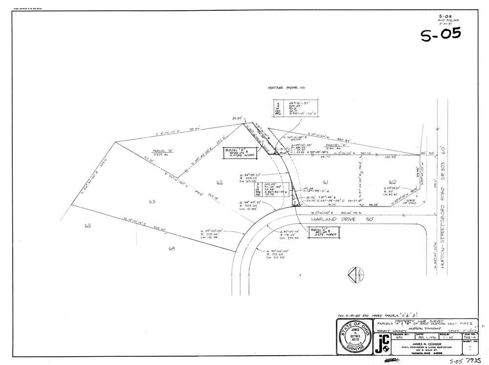
7935
Download lotsplits7935.tif
GIS Data
Latitude:
41.2413359999998
Longitude:
-81.399486
Identification
Survey identifier:
7935
Context
Original township:
Hudson
Community list:
Hudson
Surveyed on:
12/01/1976
Description
Owner:
Description:
East Hudson Hills Part Ii Parcels "A" & "B"
Primary road:
Harland Dr
Secondary road:
Near intersection:
Streetsboro Rd
Acreage:
0.0905
Survey Locators
Tract list:
Lot list:
Section list:
Quarter:
Surveyor
Surveyor number:
4570
Surveyor name:
Connor, James N.
Company:
Jc Connor & Associates, Inc.
Document Data
Scan File Name:
lotsplits7935.tif
Scan Pages:
1
Drawer location: