Toggle navigation
Survey Documents
Advanced Search
Supporting Data
Companies
Surveyors
Communities
Original Townships
APIs
Survey Documents API
Tutorial
About
Contact
Search
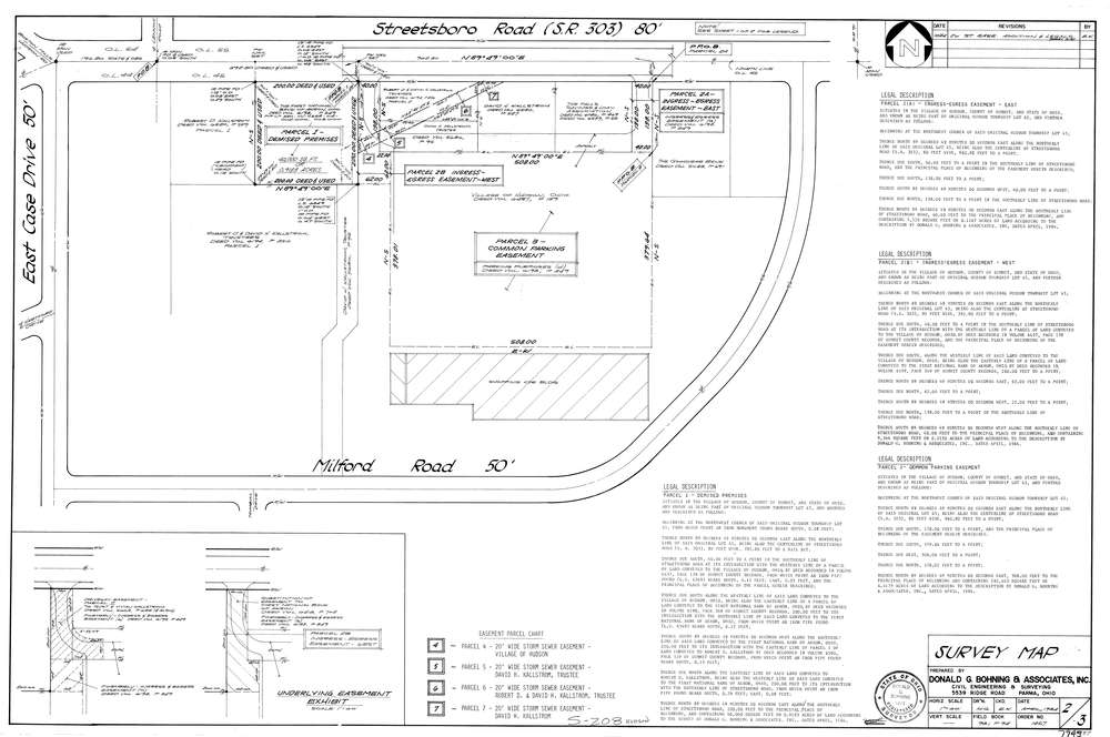
7945
Download lotsplits7945.tif
GIS Data
Latitude:
41.2388019999999
Longitude:
-81.448731
Identification
Survey identifier:
7945
Context
Original township:
Hudson
Community list:
Hudson
Surveyed on:
Description
Owner:
Description:
Primary road:
Streetsboro Rd
Secondary road:
Near intersection:
East Case Dr
Acreage:
Survey Locators
Tract list:
Lot list:
45
Section list:
Quarter:
Surveyor
Surveyor number:
4571
Surveyor name:
Bohning, Donald G.
Company:
Donald G. Bohning & Associates, Inc.
Document Data
Scan File Name:
lotsplits7945.tif
Scan Pages:
1
Drawer location: