Toggle navigation
Survey Documents
Advanced Search
Supporting Data
Companies
Surveyors
Communities
Original Townships
APIs
Survey Documents API
Tutorial
About
Contact
Search
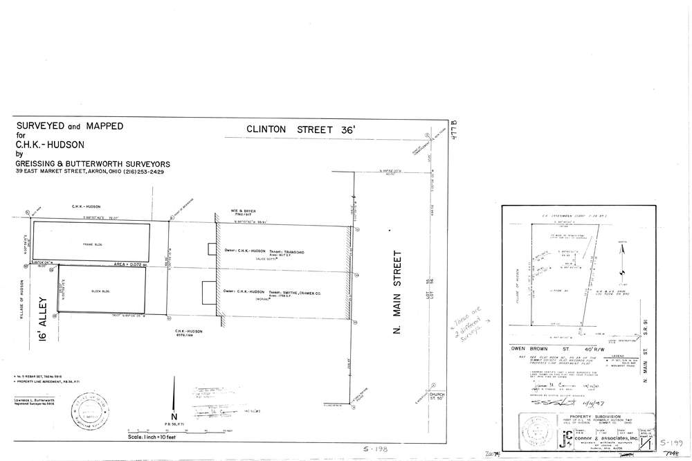
7948
Download lotsplits7948.tif
GIS Data
Latitude:
41.2435539999999
Longitude:
-81.444494
Identification
Survey identifier:
7948
Context
Original township:
Hudson
Community list:
Hudson
Surveyed on:
10/01/1987
Description
Owner:
Description:
Primary road:
Owen Brown St
Secondary road:
Near intersection:
North Main St
Acreage:
0.5926
Survey Locators
Tract list:
Lot list:
55
Section list:
Quarter:
Surveyor
Surveyor number:
4570
Surveyor name:
Connor, James N.
Company:
Jc Connor & Associates, Inc.
Document Data
Scan File Name:
lotsplits7948.tif
Scan Pages:
1
Drawer location: