Toggle navigation
Survey Documents
Advanced Search
Supporting Data
Companies
Surveyors
Communities
Original Townships
APIs
Survey Documents API
Tutorial
About
Contact
Search
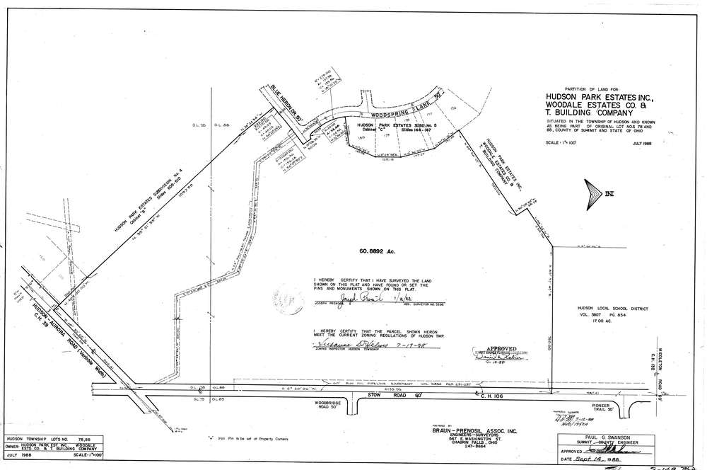
7962
Download lotsplits7962.tif
GIS Data
Latitude:
41.2644529999999
Longitude:
-81.412704
Identification
Survey identifier:
7962
Context
Original township:
Hudson
Community list:
Hudson
Surveyed on:
07/01/1988
Description
Owner:
Description:
Primary road:
Stow Rd
Secondary road:
Aurora Rd
Near intersection:
Middleton Rd
Acreage:
60.8892
Survey Locators
Tract list:
Lot list:
78, 88
Section list:
Quarter:
Surveyor
Surveyor number:
5396
Surveyor name:
Prenosil, Joseph
Company:
Document Data
Scan File Name:
lotsplits7962.tif
Scan Pages:
1
Drawer location: