Toggle navigation
Survey Documents
Advanced Search
Supporting Data
Companies
Surveyors
Communities
Original Townships
APIs
Survey Documents API
Tutorial
About
Contact
Search
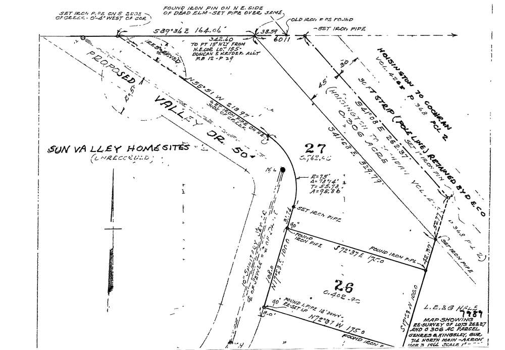
7989
Download lotsplits7989.tif
GIS Data
Latitude:
41.0218249999998
Longitude:
-81.427402
Identification
Survey identifier:
7989
Context
Original township:
Springfield
Community list:
Cuyahoga Falls
Surveyed on:
03/03/1966
Description
Owner:
Description:
Primary road:
Valley Dr
Secondary road:
Near intersection:
Adams St
Acreage:
1.164
Survey Locators
Tract list:
Lot list:
Section list:
Quarter:
Surveyor
Surveyor number:
Surveyor name:
Company:
Gehres & Kingsley, Surveyors
Document Data
Scan File Name:
lotsplits7989.tif
Scan Pages:
1
Drawer location: