Toggle navigation
Survey Documents
Advanced Search
Supporting Data
Companies
Surveyors
Communities
Original Townships
APIs
Survey Documents API
Tutorial
About
Contact
Search
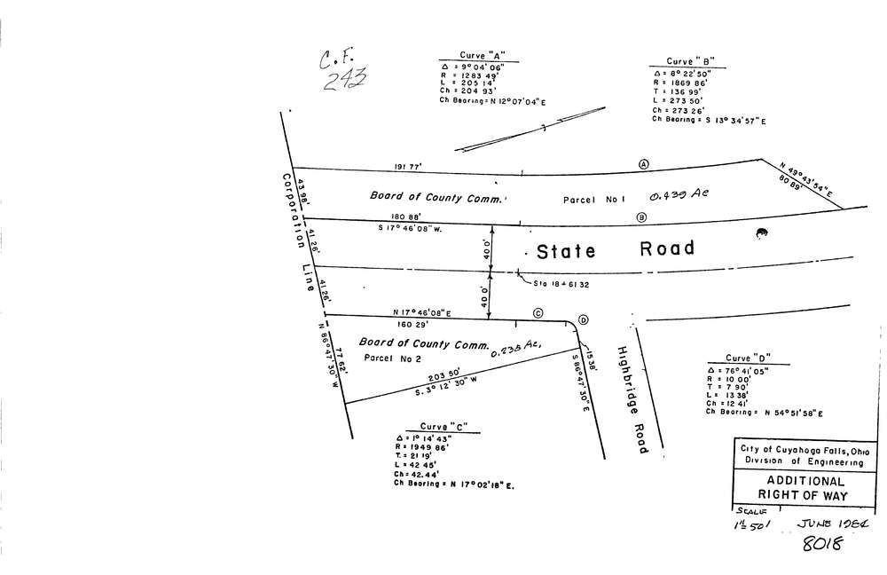
8018
Download lotsplits8018.tif
GIS Data
Latitude:
41.1246569999999
Longitude:
-81.508727
Identification
Survey identifier:
8018
Context
Original township:
Cuyahoga Falls
Community list:
Cuyahoga Falls
Surveyed on:
06/01/1984
Description
Owner:
Description:
Primary road:
State Rd
Secondary road:
Near intersection:
Highbridge Rd
Acreage:
0.439
Survey Locators
Tract list:
Lot list:
Section list:
Quarter:
Surveyor
Surveyor number:
0
Surveyor name:
Company:
Document Data
Scan File Name:
lotsplits8018.tif
Scan Pages:
1
Drawer location: