Toggle navigation
Survey Documents
Advanced Search
Supporting Data
Companies
Surveyors
Communities
Original Townships
APIs
Survey Documents API
Tutorial
About
Contact
Search
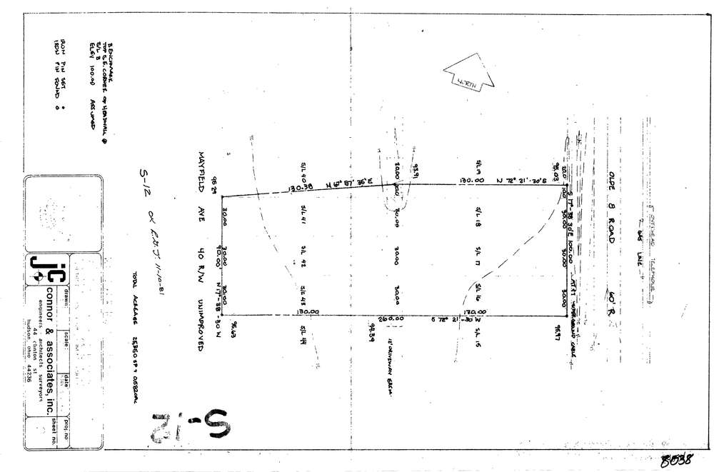
8038
Download lotsplits8038.tif
GIS Data
Latitude:
41.2819989999999
Longitude:
-81.516098
Identification
Survey identifier:
8038
Context
Original township:
Northfield
Community list:
Northfield
Surveyed on:
05/26/1981
Description
Owner:
Description:
S/L 16 18 & 41 43 Northfield Heights Vol. 32 Pg. 24
Primary road:
Olde Eight Rd
Secondary road:
Mayfield Ave
Near intersection:
Oakdale Ave
Acreage:
Survey Locators
Tract list:
Lot list:
Section list:
Quarter:
Surveyor
Surveyor number:
4570
Surveyor name:
Connor, James N.
Company:
Jc Connor & Associates, Inc.
Document Data
Scan File Name:
lotsplits8038.tif
Scan Pages:
1
Drawer location: