Toggle navigation
Survey Documents
Advanced Search
Supporting Data
Companies
Surveyors
Communities
Original Townships
APIs
Survey Documents API
Tutorial
About
Contact
Search
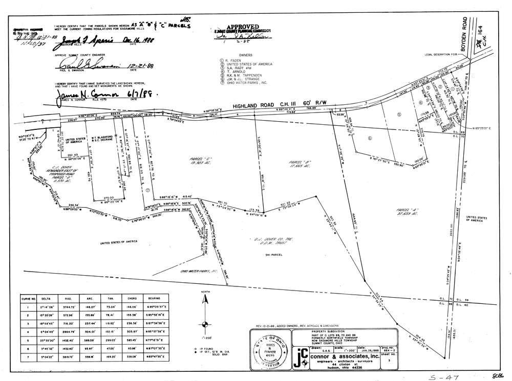
8086
Download lotsplits8086.tif
GIS Data
Latitude:
41.2878679999999
Longitude:
-81.556149
Identification
Survey identifier:
8086
Context
Original township:
Northfield
Community list:
Sagamore Hills
Surveyed on:
06/07/1988
Description
Owner:
Description:
Primary road:
Highland Rd
Secondary road:
Near intersection:
Boyden Rd
Acreage:
75.247
Survey Locators
Tract list:
Lot list:
69, 70, 88
Section list:
Quarter:
Surveyor
Surveyor number:
4570
Surveyor name:
Connor, James N.
Company:
Jc Connor & Associates, Inc.
Document Data
Scan File Name:
lotsplits8086.tif
Scan Pages:
1
Drawer location: