Toggle navigation
Survey Documents
Advanced Search
Supporting Data
Companies
Surveyors
Communities
Original Townships
APIs
Survey Documents API
Tutorial
About
Contact
Search
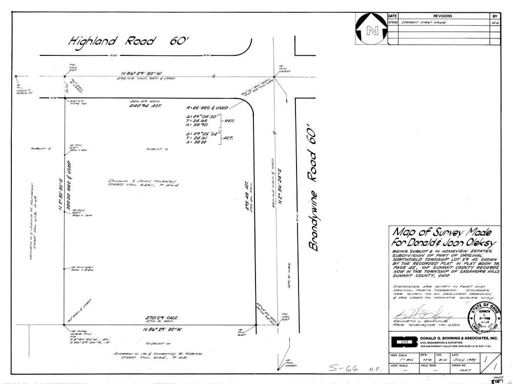
8087
Download lotsplits8087.tif
GIS Data
Latitude:
41.2920279999999
Longitude:
-81.53954
Identification
Survey identifier:
8087
Context
Original township:
Northfield
Community list:
Sagamore Hills
Surveyed on:
07/01/1985
Description
Owner:
Olesky
Description:
Primary road:
Brandywine Rd
Secondary road:
Highland Rd
Near intersection:
Acreage:
Survey Locators
Tract list:
Lot list:
59
Section list:
Quarter:
Surveyor
Surveyor number:
6720
Surveyor name:
Bohning, Kenneth L.
Company:
Hejduck Cox & Associates
Document Data
Scan File Name:
lotsplits8087.tif
Scan Pages:
1
Drawer location: