Toggle navigation
Survey Documents
Advanced Search
Supporting Data
Companies
Surveyors
Communities
Original Townships
APIs
Survey Documents API
Tutorial
About
Contact
Search
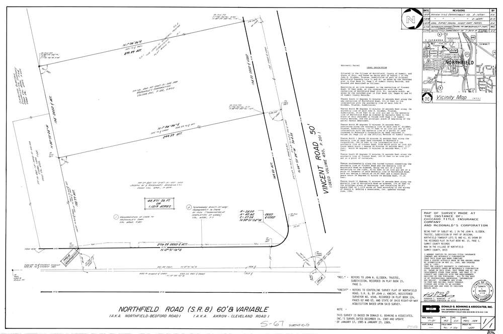
8096
Download lotsplits8096.tif
GIS Data
Latitude:
41.3486809999999
Longitude:
-81.527621
Identification
Survey identifier:
8096
Context
Original township:
Northfield
Community list:
Northfield
Surveyed on:
05/01/1989
Description
Owner:
Mcdonalds Corporation
Description:
Part Of Sublot #1 John N. Glidden Subdivision P.B. 15 Pg. 1
Primary road:
Northfield Rd
Secondary road:
Near intersection:
Vincent Rd
Acreage:
1.1219
Survey Locators
Tract list:
Lot list:
31, 41
Section list:
Quarter:
Surveyor
Surveyor number:
6720
Surveyor name:
Bohning, Kenneth L.
Company:
Donald G. Bohning & Associates, Inc.
Document Data
Scan File Name:
lotsplits8096.tif
Scan Pages:
1
Drawer location: