Toggle navigation
Survey Documents
Advanced Search
Supporting Data
Companies
Surveyors
Communities
Original Townships
APIs
Survey Documents API
Tutorial
About
Contact
Search
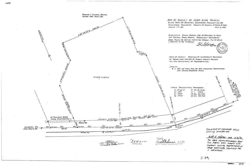
8099
Download lotsplits8099.tif
GIS Data
Latitude:
41.3157069999998
Longitude:
-81.571534
Identification
Survey identifier:
8099
Context
Original township:
Northfield
Community list:
Sagamore Hills
Surveyed on:
11/02/1987
Description
Owner:
Description:
Primary road:
Aurora Rd (S.R. 82)
Secondary road:
Near intersection:
Carter Rd
Acreage:
10.069
Survey Locators
Tract list:
Lot list:
85
Section list:
Quarter:
Surveyor
Surveyor number:
4504
Surveyor name:
Salango, Pat
Company:
Document Data
Scan File Name:
lotsplits8099.tif
Scan Pages:
1
Drawer location: