Toggle navigation
Survey Documents
Advanced Search
Supporting Data
Companies
Surveyors
Communities
Original Townships
APIs
Survey Documents API
Tutorial
About
Contact
Search
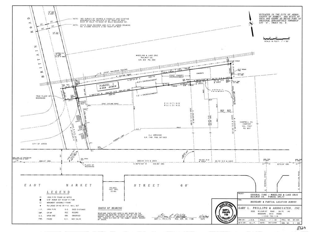
8129
Download lotsplits8129.tif
GIS Data
Latitude:
41.0627859999998
Longitude:
-81.465855
Identification
Survey identifier:
8129
Context
Original township:
Springfield
Community list:
Akron
Surveyed on:
04/12/1994
Description
Owner:
Description:
Primary road:
Brittain Rd
Secondary road:
Near intersection:
East Market St
Acreage:
0.259
Survey Locators
Tract list:
3
Lot list:
A
Section list:
Quarter:
Surveyor
Surveyor number:
7189
Surveyor name:
Phillips, Gary L.
Company:
Gary L. Phillips & Associates
Document Data
Scan File Name:
lotsplits8129.tif
Scan Pages:
1
Drawer location: