Toggle navigation
Survey Documents
Advanced Search
Supporting Data
Companies
Surveyors
Communities
Original Townships
APIs
Survey Documents API
Tutorial
About
Contact
Search
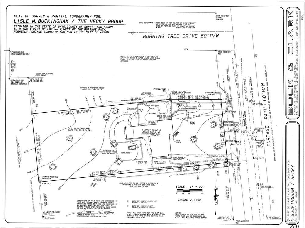
8131
Download lotsplits8131.tif
GIS Data
Latitude:
41.1095589999998
Longitude:
-81.548874
Identification
Survey identifier:
8131
Context
Original township:
Portage
Community list:
Akron
Surveyed on:
08/07/1992
Description
Owner:
Buckingham
Description:
Primary road:
Portage Path
Secondary road:
Near intersection:
Burning Tree Dr
Acreage:
Survey Locators
Tract list:
Lot list:
7
Section list:
Quarter:
Surveyor
Surveyor number:
7368
Surveyor name:
Moyer, James E.
Company:
Bock & Clark
Document Data
Scan File Name:
lotsplits8131.tif
Scan Pages:
1
Drawer location: