Toggle navigation
Survey Documents
Advanced Search
Supporting Data
Companies
Surveyors
Communities
Original Townships
APIs
Survey Documents API
Tutorial
About
Contact
Search
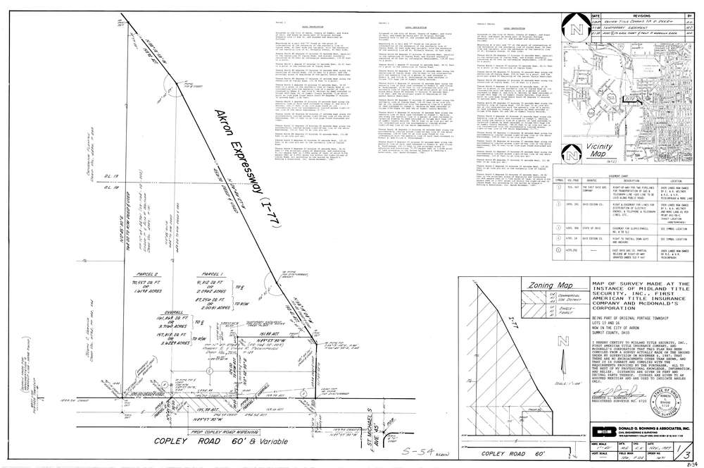
8134
Download lotsplits8134.tif
GIS Data
Latitude:
41.0840739999999
Longitude:
-81.581211
Identification
Survey identifier:
8134
Context
Original township:
Portage
Community list:
Akron
Surveyed on:
11/01/1987
Description
Owner:
Mcdonald'S Corporation
Description:
Primary road:
Copley Rd
Secondary road:
I 77
Near intersection:
St Michaels Ave
Acreage:
3.6229
Survey Locators
Tract list:
Lot list:
13, 16
Section list:
Quarter:
Surveyor
Surveyor number:
6720
Surveyor name:
Bohning, Kenneth L.
Company:
Donald G. Bohning & Associates, Inc.
Document Data
Scan File Name:
lotsplits8134.tif
Scan Pages:
1
Drawer location: