Toggle navigation
Survey Documents
Advanced Search
Supporting Data
Companies
Surveyors
Communities
Original Townships
APIs
Survey Documents API
Tutorial
About
Contact
Search
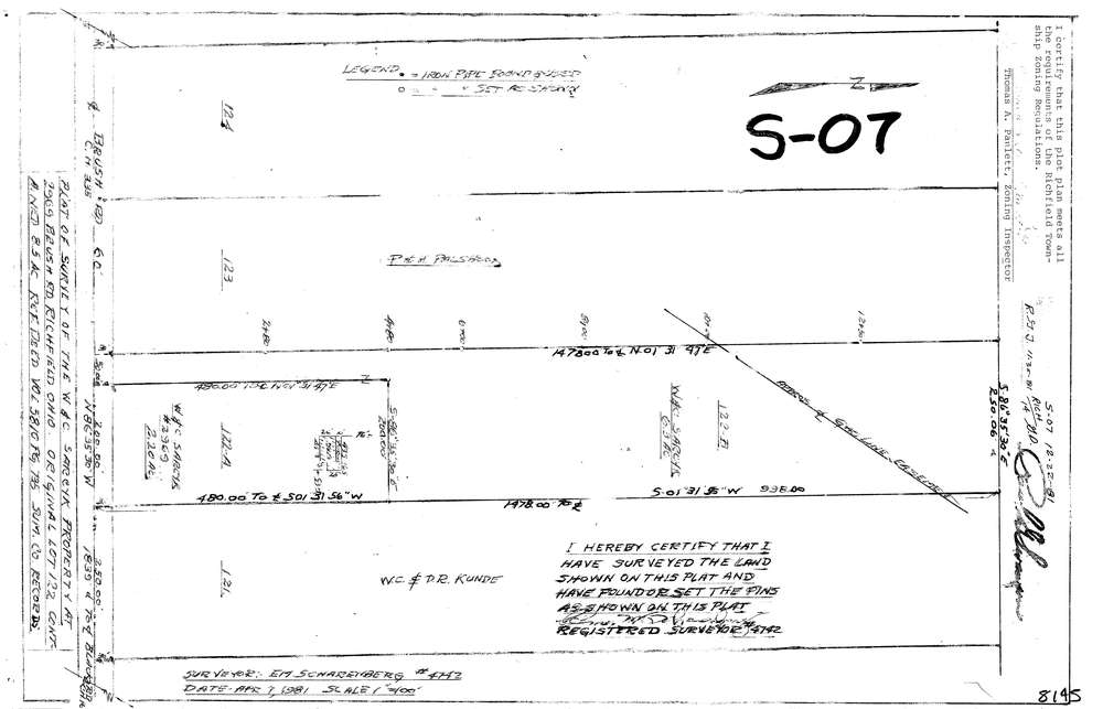
8145
Download lotsplits8145.tif
GIS Data
Latitude:
41.2549679999998
Longitude:
-81.615629
Identification
Survey identifier:
8145
Context
Original township:
Richfield
Community list:
Richfield
Surveyed on:
04/07/1981
Description
Owner:
Description:
Primary road:
Brush Rd
Secondary road:
Near intersection:
Black Rd
Acreage:
8.5
Survey Locators
Tract list:
Lot list:
Section list:
Quarter:
Surveyor
Surveyor number:
4742
Surveyor name:
Scharenberg, Elmer M.
Company:
Document Data
Scan File Name:
lotsplits8145.tif
Scan Pages:
1
Drawer location: