Toggle navigation
Survey Documents
Advanced Search
Supporting Data
Companies
Surveyors
Communities
Original Townships
APIs
Survey Documents API
Tutorial
About
Contact
Search
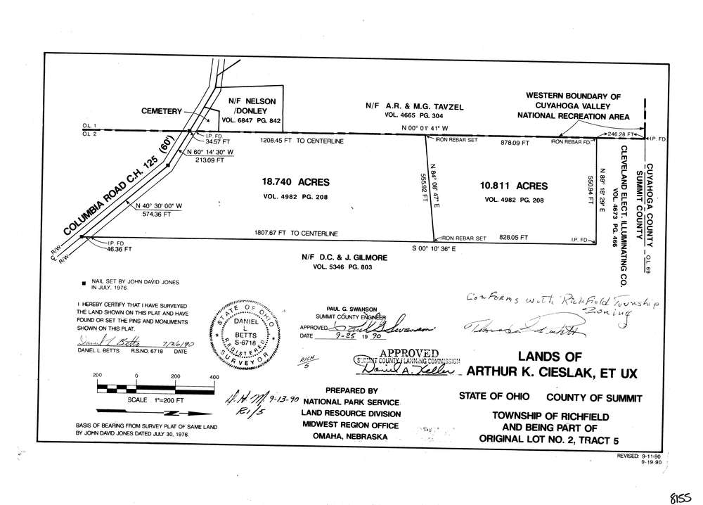
8155
Download lotsplits8155.tif
GIS Data
Latitude:
41.2726139999998
Longitude:
-81.595802
Identification
Survey identifier:
8155
Context
Original township:
Richfield
Community list:
Richfield
Surveyed on:
07/26/1990
Description
Owner:
Cieslak, Et Ux
Description:
National Park Service
Primary road:
Columbia Rd
Secondary road:
Near intersection:
Dewey Rd
Acreage:
29.551
Survey Locators
Tract list:
5
Lot list:
2
Section list:
Quarter:
Surveyor
Surveyor number:
6718
Surveyor name:
Betts, Daniel L.
Company:
Document Data
Scan File Name:
lotsplits8155.tif
Scan Pages:
1
Drawer location: