Toggle navigation
Survey Documents
Advanced Search
Supporting Data
Companies
Surveyors
Communities
Original Townships
APIs
Survey Documents API
Tutorial
About
Contact
Search
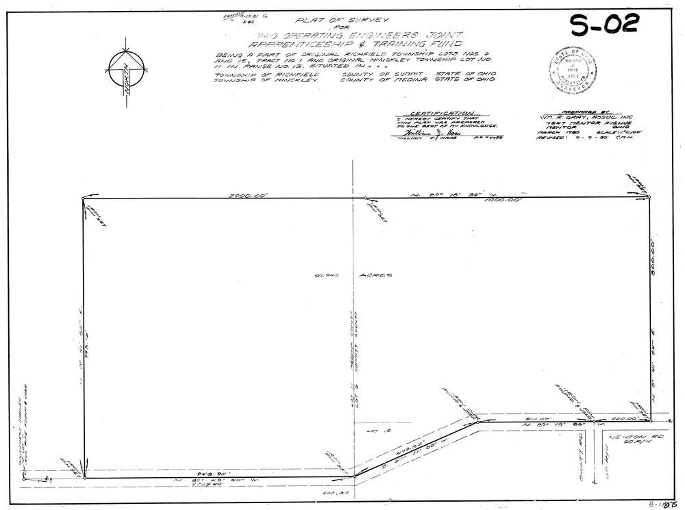
8175
Download lotsplits8175.tif
GIS Data
Latitude:
41.2624849999998
Longitude:
-81.683393
Identification
Survey identifier:
8175
Context
Original township:
Richfield
Community list:
Richfield
Surveyed on:
07/09/1980
Description
Owner:
Description:
Primary road:
Newton Rd
Secondary road:
Near intersection:
Oviatt Rd
Acreage:
41.94
Survey Locators
Tract list:
1
Lot list:
15, 6
Section list:
Quarter:
Surveyor
Surveyor number:
4793
Surveyor name:
Haas, William J.
Company:
Wm. R. Gray, Associates, Inc.
Document Data
Scan File Name:
lotsplits8175.tif
Scan Pages:
1
Drawer location: