Toggle navigation
Survey Documents
Advanced Search
Supporting Data
Companies
Surveyors
Communities
Original Townships
APIs
Survey Documents API
Tutorial
About
Contact
Search
8198
Download lotsplits8198.tif
GIS Data
Latitude:
41.0182139999998
Longitude:
-81.425922
Identification
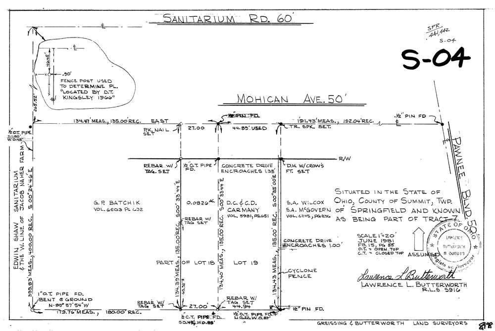
Survey identifier:
8198
Context
Original township:
Springfield
Community list:
Springfield
Surveyed on:
06/01/1981
Description
Owner:
Description:
Primary road:
Mohican Ave
Secondary road:
Near intersection:
Pawnee Blvd
Acreage:
0.0826
Survey Locators
Tract list:
7
Lot list:
Section list:
Quarter:
Surveyor
Surveyor number:
5916
Surveyor name:
Butterworth, Lawrence L.
Company:
Greissing & Butterworth
Document Data
Scan File Name:
lotsplits8198.tif
Scan Pages:
1
Drawer location: