Toggle navigation
Survey Documents
Advanced Search
Supporting Data
Companies
Surveyors
Communities
Original Townships
APIs
Survey Documents API
Tutorial
About
Contact
Search
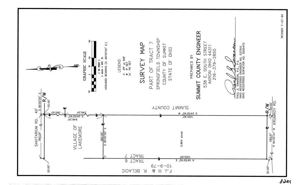
8201
Download lotsplits8201.tif
GIS Data
Latitude:
41.0175019999999
Longitude:
-81.435771
Identification
Survey identifier:
8201
Context
Original township:
Springfield
Community list:
Springfield
Surveyed on:
07/27/1990
Description
Owner:
Description:
Primary road:
Krumroy Rd
Secondary road:
Sanitarium Rd
Near intersection:
Flickinger Rd
Acreage:
5.864
Survey Locators
Tract list:
7
Lot list:
Section list:
Quarter:
Surveyor
Surveyor number:
5470
Surveyor name:
Swanson, Paul G.
Company:
County Of Summit Engineer
Document Data
Scan File Name:
lotsplits8201.tif
Scan Pages:
1
Drawer location: