Toggle navigation
Survey Documents
Advanced Search
Supporting Data
Companies
Surveyors
Communities
Original Townships
APIs
Survey Documents API
Tutorial
About
Contact
Search
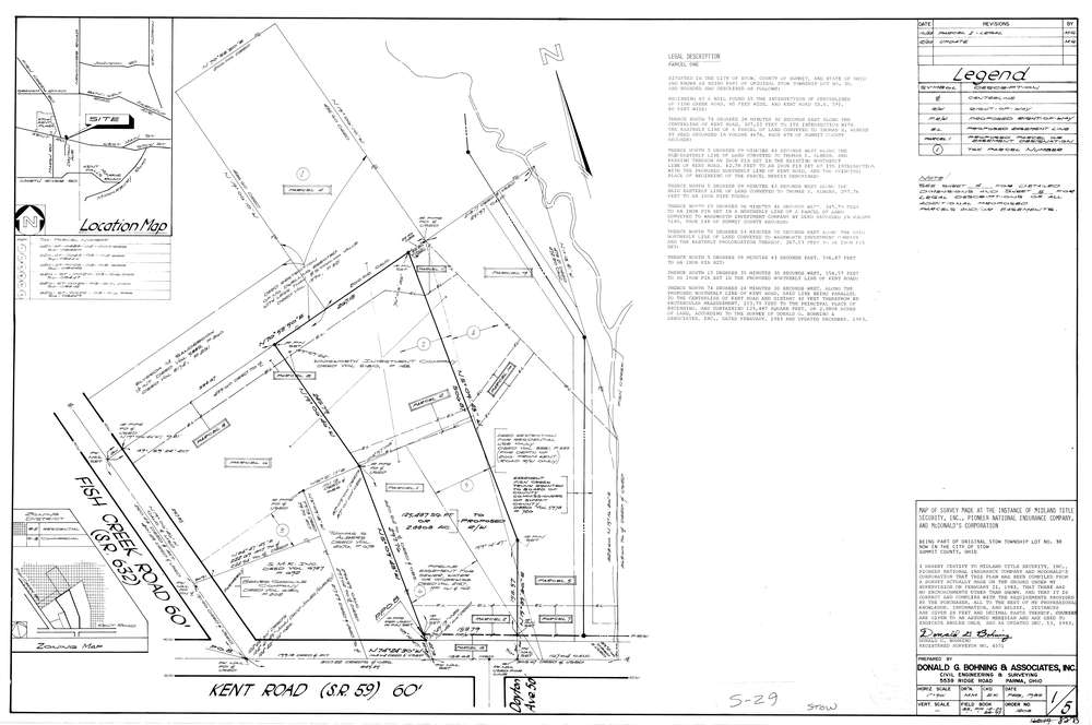
8273
Download lotsplits8273.tif
GIS Data
Latitude:
41.1555549999998
Longitude:
-81.397362
Identification
Survey identifier:
8273
Context
Original township:
Stow
Community list:
Stow
Surveyed on:
02/01/1983
Description
Owner:
McDonald'S Corporation
Description:
Primary road:
Kent Rd
Secondary road:
Near intersection:
Dayton Ave
Acreage:
2.8808
Survey Locators
Tract list:
Lot list:
30
Section list:
Quarter:
Surveyor
Surveyor number:
4571
Surveyor name:
Bohning, Donald G.
Company:
Donald G. Bohning & Associates, Inc.
Document Data
Scan File Name:
lotsplits8273.tif
Scan Pages:
1
Drawer location: