Toggle navigation
Survey Documents
Advanced Search
Supporting Data
Companies
Surveyors
Communities
Original Townships
APIs
Survey Documents API
Tutorial
About
Contact
Search
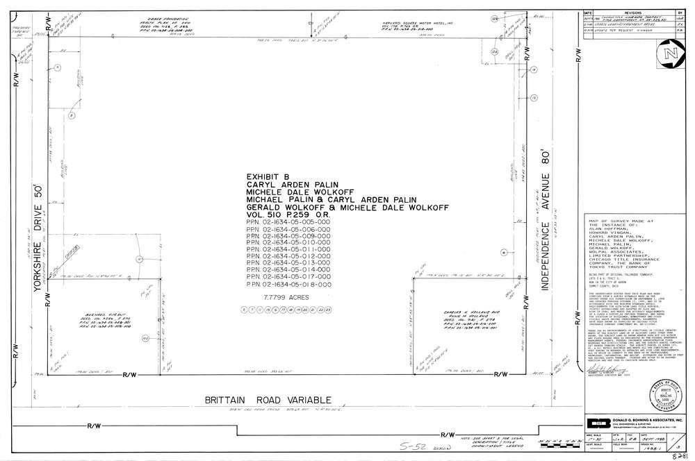
8281
Download lotsplits8281.tif
GIS Data
Latitude:
41.1096559999999
Longitude:
-81.4677
Identification
Survey identifier:
8281
Context
Original township:
Tallmadge
Community list:
Tallmadge
Surveyed on:
09/01/1988
Description
Owner:
Description:
Primary road:
Brittain Rd
Secondary road:
Yorkshire Dr
Near intersection:
Independence Ave
Acreage:
7.7799
Survey Locators
Tract list:
5
Lot list:
3, 6
Section list:
Quarter:
Surveyor
Surveyor number:
5000
Surveyor name:
Bohning, Robert J.
Company:
Donald G. Bohning & Associates, Inc.
Document Data
Scan File Name:
lotsplits8281.tif
Scan Pages:
1
Drawer location: