Toggle navigation
Survey Documents
Advanced Search
Supporting Data
Companies
Surveyors
Communities
Original Townships
APIs
Survey Documents API
Tutorial
About
Contact
Search
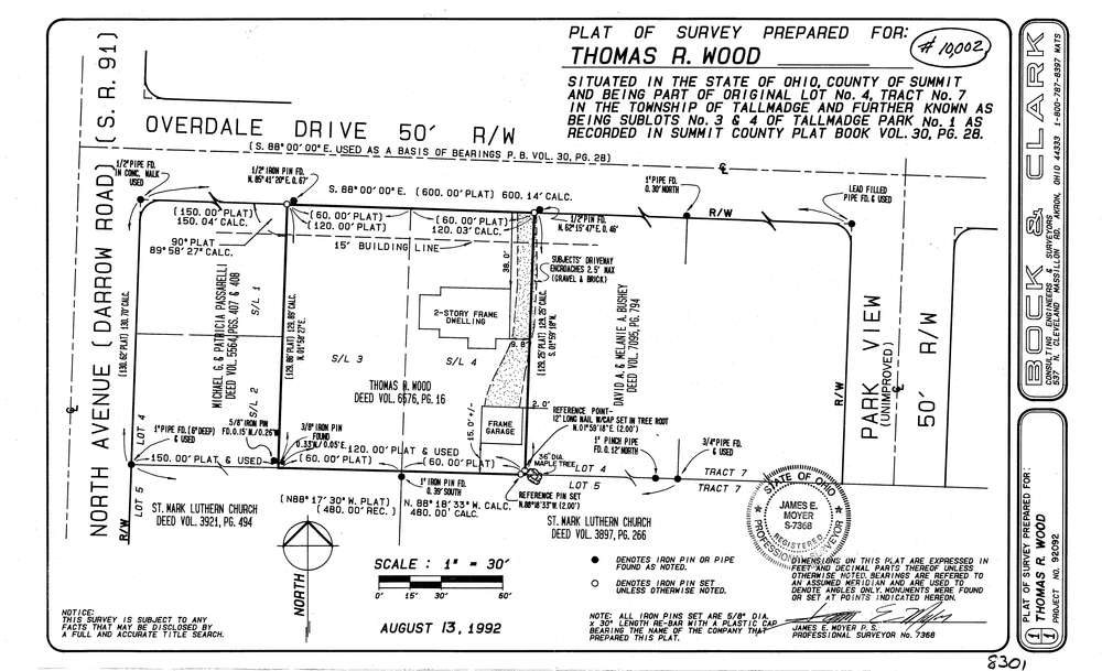
8301
Download lotsplits8301.tif
GIS Data
Latitude:
41.1070119999998
Longitude:
-81.43988
Identification
Survey identifier:
8301
Context
Original township:
Tallmadge
Community list:
Tallmadge
Surveyed on:
08/13/1992
Description
Owner:
Wood
Description:
Sub Lots 3&4 Tallmadge Park #1 P.B. 30 Pg. 28
Primary road:
Overdale Dr
Secondary road:
North Ave
Near intersection:
Park View Terrace
Acreage:
Survey Locators
Tract list:
7
Lot list:
4
Section list:
Quarter:
Surveyor
Surveyor number:
7368
Surveyor name:
Moyer, James E.
Company:
Bock & Clark
Document Data
Scan File Name:
lotsplits8301.tif
Scan Pages:
1
Drawer location: