Toggle navigation
Survey Documents
Advanced Search
Supporting Data
Companies
Surveyors
Communities
Original Townships
APIs
Survey Documents API
Tutorial
About
Contact
Search
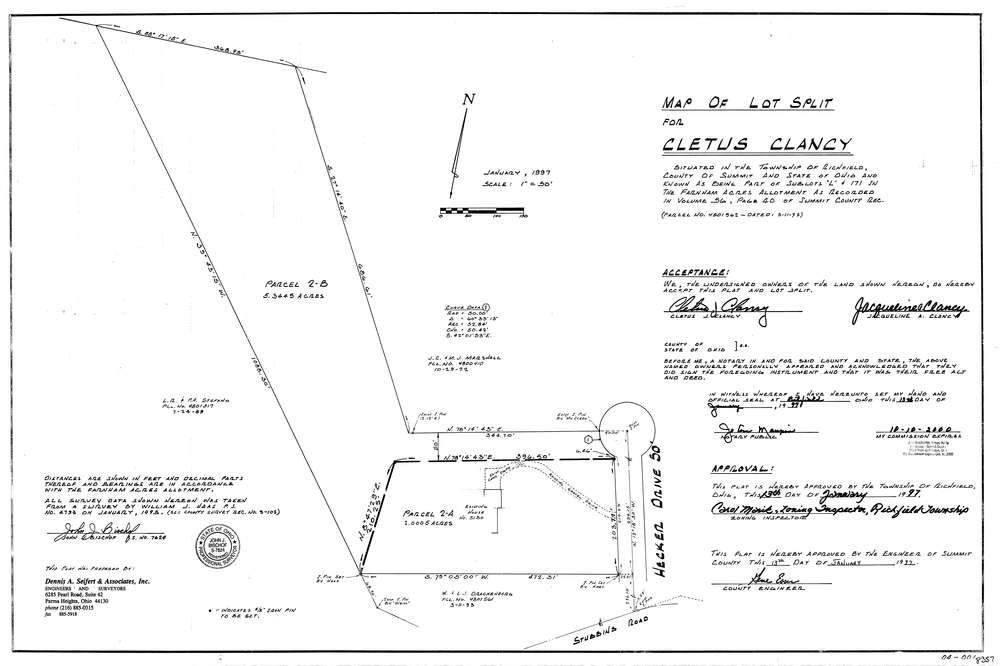
8357
Download lotsplits8357.tif
GIS Data
Latitude:
41.2701139999999
Longitude:
-81.616509
Identification
Survey identifier:
8357
Context
Original township:
Richfield
Community list:
Richfield
Surveyed on:
01/13/1997
Description
Owner:
Clancy
Description:
Sublots "L" & 171 In The Farnham Acres Allotment Volume 56 Pg. 40
Primary road:
Hecker Dr
Secondary road:
Near intersection:
Stubbins Rd
Acreage:
7.3
Survey Locators
Tract list:
Lot list:
Section list:
Quarter:
Surveyor
Surveyor number:
7624
Surveyor name:
Bischof, John J.
Company:
Dennis A. Seifert & Associates Inc
Document Data
Scan File Name:
lotsplits8357.tif
Scan Pages:
1
Drawer location: