Toggle navigation
Survey Documents
Advanced Search
Supporting Data
Companies
Surveyors
Communities
Original Townships
APIs
Survey Documents API
Tutorial
About
Contact
Search
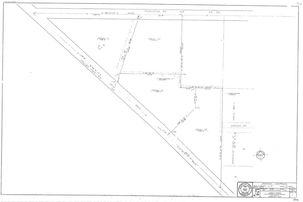
8370
Download lotsplits8370.tif
GIS Data
Latitude:
41.2691539999999
Longitude:
-81.462475
Identification
Survey identifier:
8370
Context
Original township:
Hudson
Community list:
Hudson
Surveyed on:
06/14/1976
Description
Owner:
Description:
Primary road:
Valley View Rd
Secondary road:
Near intersection:
Middleton Rd
Acreage:
10.6
Survey Locators
Tract list:
Lot list:
83
Section list:
Quarter:
Surveyor
Surveyor number:
4570
Surveyor name:
Connor, James N.
Company:
Jc Connor & Associates, Inc.
Document Data
Scan File Name:
lotsplits8370.tif
Scan Pages:
1
Drawer location: