Toggle navigation
Survey Documents
Advanced Search
Supporting Data
Companies
Surveyors
Communities
Original Townships
APIs
Survey Documents API
Tutorial
About
Contact
Search
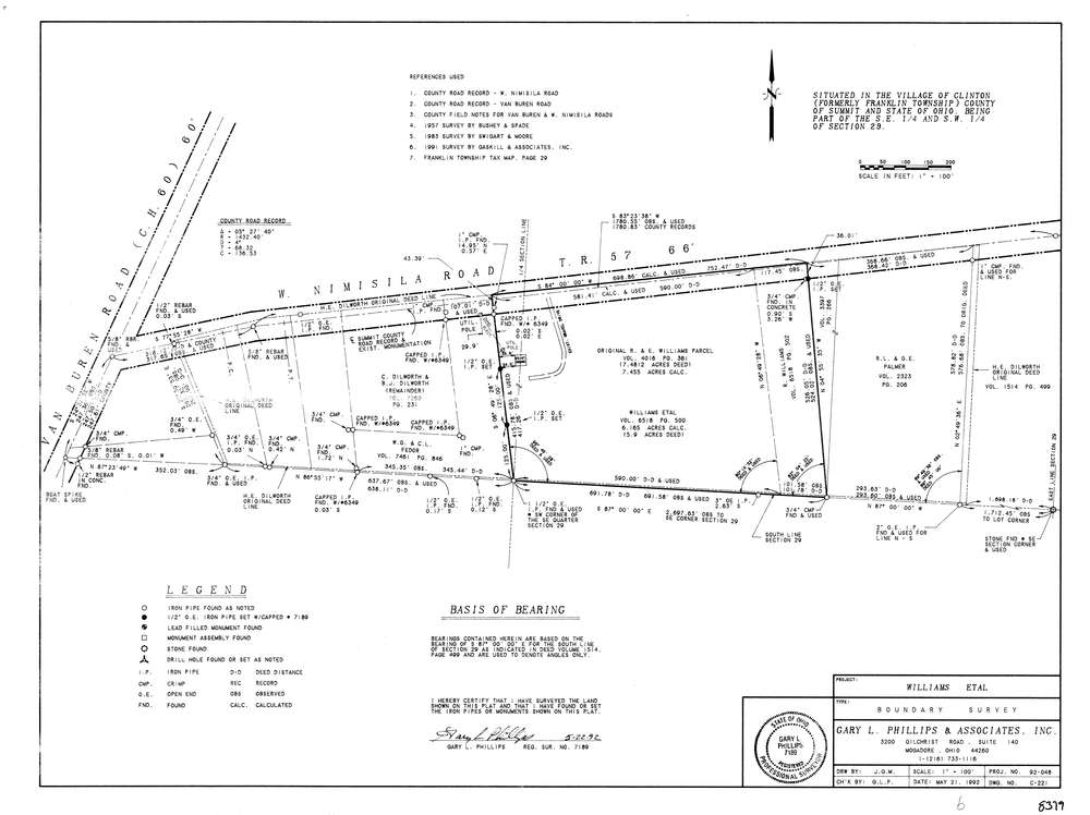
8379
Download lotsplits8379.tif
GIS Data
Latitude:
40.9291749999998
Longitude:
-81.619105
Identification
Survey identifier:
8379
Context
Original township:
Franklin
Community list:
Clinton
Surveyed on:
05/22/1992
Description
Owner:
Williams
Description:
Also Part Of The Sw Quarter
Primary road:
West Nimisila Rd
Secondary road:
Near intersection:
Van Buren Rd
Acreage:
7.4812
Survey Locators
Tract list:
Lot list:
Section list:
29
Quarter:
SE
Surveyor
Surveyor number:
7189
Surveyor name:
Phillips, Gary L.
Company:
Gary L. Phillips & Associates
Document Data
Scan File Name:
lotsplits8379.tif
Scan Pages:
1
Drawer location: