Toggle navigation
Survey Documents
Advanced Search
Supporting Data
Companies
Surveyors
Communities
Original Townships
APIs
Survey Documents API
Tutorial
About
Contact
Search
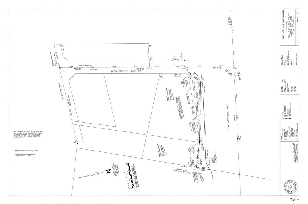
9607
Download lotsplits9607.tif
GIS Data
Latitude:
41.0273449999998
Longitude:
-81.537952
Identification
Survey identifier:
9607
Context
Original township:
Coventry
Community list:
Coventry
Surveyed on:
Description
Owner:
Description:
Primary road:
Ley Dr
Secondary road:
Waterlood Rd
Near intersection:
Acreage:
0.838
Survey Locators
Tract list:
11
Lot list:
Section list:
Quarter:
Surveyor
Surveyor number:
5916
Surveyor name:
Butterworth, Lawrence L.
Company:
Greissing & Butterworth
Document Data
Scan File Name:
lotsplits9607.tif
Scan Pages:
1
Drawer location: