Toggle navigation
Survey Documents
Advanced Search
Supporting Data
Companies
Surveyors
Communities
Original Townships
APIs
Survey Documents API
Tutorial
About
Contact
Search
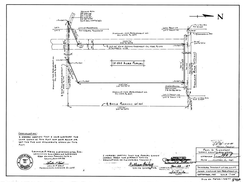
8404
Download lotsplits8404.tif
GIS Data
Latitude:
41.2963809999999
Longitude:
-81.471004
Identification
Survey identifier:
8404
Context
Original township:
Twinsburg
Community list:
Twinsburg
Surveyed on:
09/01/1987
Description
Owner:
Highland Som Development Co.
Description:
Primary road:
Highland Rd
Secondary road:
Near intersection:
Chamberlin Rd
Acreage:
10.0
Survey Locators
Tract list:
1
Lot list:
6, 7
Section list:
Quarter:
Surveyor
Surveyor number:
6627
Surveyor name:
Kent, Leslie P.
Company:
Seymour D. Weiss & Associates
Document Data
Scan File Name:
lotsplits8404.tif
Scan Pages:
1
Drawer location: