Toggle navigation
Survey Documents
Advanced Search
Supporting Data
Companies
Surveyors
Communities
Original Townships
APIs
Survey Documents API
Tutorial
About
Contact
Search
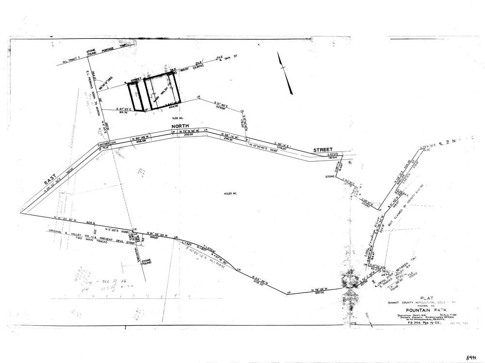
8441
Download lotsplits8441.tif
GIS Data
Latitude:
41.0902199999999
Longitude:
-81.498567
Identification
Survey identifier:
8441
Context
Original township:
Portage
Community list:
Akron
Surveyed on:
Description
Owner:
Summit County Agricultural Society
Description:
Primary road:
East North St
Secondary road:
Near intersection:
Dan St
Acreage:
48.25
Survey Locators
Tract list:
7
Lot list:
Section list:
Quarter:
Surveyor
Surveyor number:
Surveyor name:
Company:
County Of Summit Engineer
Document Data
Scan File Name:
lotsplits8441.tif
Scan Pages:
1
Drawer location: