Toggle navigation
Survey Documents
Advanced Search
Supporting Data
Companies
Surveyors
Communities
Original Townships
APIs
Survey Documents API
Tutorial
About
Contact
Search
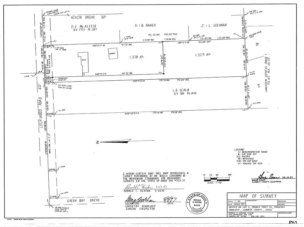
8469
Download lotsplits8469.tif
GIS Data
Latitude:
40.9983727999998
Longitude:
-81.5646631
Identification
Survey identifier:
8469
Context
Original township:
Coventry
Community list:
Coventry
Surveyed on:
03/27/1997
Description
Owner:
Description:
Primary road:
Lockwood Rd
Secondary road:
Kevin Dr
Near intersection:
Greenbay Dr
Acreage:
2.6
Survey Locators
Tract list:
14
Lot list:
2
Section list:
Quarter:
Surveyor
Surveyor number:
6270
Surveyor name:
Hinton, Ronald C.
Company:
Document Data
Scan File Name:
lotsplits8469.tif
Scan Pages:
1
Drawer location: