Toggle navigation
Survey Documents
Advanced Search
Supporting Data
Companies
Surveyors
Communities
Original Townships
APIs
Survey Documents API
Tutorial
About
Contact
Search
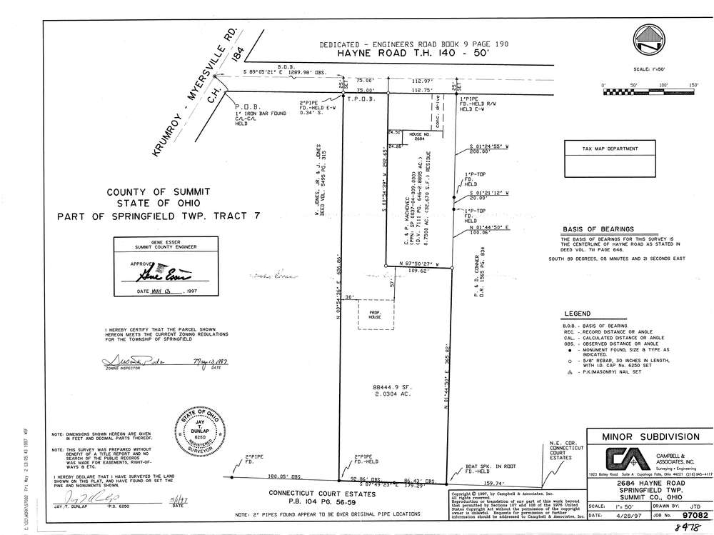
8478
Download lotsplits8478.tif
GIS Data
Latitude:
41.0024919999998
Longitude:
-81.427596
Identification
Survey identifier:
8478
Context
Original township:
Springfield
Community list:
Springfield
Surveyed on:
04/28/1997
Description
Owner:
Description:
Primary road:
Hayne Rd
Secondary road:
Near intersection:
Myersville Rd
Acreage:
2.0304
Survey Locators
Tract list:
7
Lot list:
Section list:
Quarter:
Surveyor
Surveyor number:
6250
Surveyor name:
Dunlap, Jay T.
Company:
Campbell & Associates
Document Data
Scan File Name:
lotsplits8478.tif
Scan Pages:
1
Drawer location: